Synopsis
‘A book worth reading’ Andrew Marr, Sunday Times
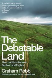
The Debatable Land was an independent territory which used to exist between Scotland and England. At the height of its notoriety, it was the bloodiest region in Great Britain, fought over by Henry VIII, Elizabeth I and James V. After the Union of the Crowns, most of its population was slaughtered or deported and it became the last part of the country to be brought under the control of the state. Today, its history has been forgotten or ignored.
When Graham Robb moved to a lonely house on the very edge of England, he discovered that the river which almost surrounded his new home had once marked the Debatable Land’s southern boundary. Under the powerful spell of curiosity, Robb began a journey – on foot, by bicycle and into the past – that would uncover lost towns and roads, reveal the truth about this maligned patch of land and result in more than one discovery of major historical significance.
Rich in detail and epic in scope, The Debatable Land takes us from a time when neither England nor Scotland could be imagined to the present day, when contemporary nationalism and political turmoil threaten to unsettle the cross-border community once more. Writing with his customary charm, wit and literary grace, Graham Robb proves the Debatable Land to be a crucial, missing piece in the puzzle of British history.
Includes a 16-page colour plate section.
Details
Reviews
Sorting out the fact from the fiction in this history is one of Robb’s tasks. He tackles some serious misconceptions about the borderland . . . Robb intercuts the past and present, the intimate and the impersonal, to wonderful effect. Few authors write so well about things lost and neglected – or have such sharp ears and eyes for the natural world
Graham Robb is a remarkable writer . . . [his work] displays curiosity, intellectual vitality, wide-ranging sympathies, and a keen eye for unexpected detail. This new book will fascinate everyone with a knowledge of the geography, history, mythology and character of the Anglo-Scottish borderlands . . . No short review can do justice to the intelligence, charm, variety and sheer interest of this book. Read it, and you will be richly entertained and enlightened.
A detective outing on native soil. Armed with energy, humour, a poet’s eye and a bicycle – all things his fans will be familiar with – Robb probes the received wisdoms of the past . . . His skill as a writer is to understand, without being fey, the fourth dimension: peeling back the modern landscape to find buried stories
Scholarly nonfiction written with novelistic flair . . . The Debatable Land was neither English nor Scottish but a law unto itself, and it became notorious as the centre of reiver violence . . . But Robb, like a conjuror, gradually shows us the Debatable Land as something else . . . his exploration of its history is punctuated by some terrific nature writing


